By: Charnelle Wickliff
Hello everyone! My name is Charnelle and I am a masters student at Moss Landing Marine Laboratories. I am co-advised through CSUMB by Dr. Corey Garza and Dr. Alison Haupt. I am excited to able to come out this summer to hike, snorkel, enjoy the island life, and fly a drone from the beach. I have been keeping myself busy this past year by finishing my thesis proposal, reading research papers, and analyzing data.
My research focuses drones and how they can be a great tool in monitor subtidal habitats, like rhodolith beds, on Catalina. My interest in drones (other than their cool factor) stems from my undergraduate experience at CSUMB building and operating remotely operated vehicles (ROVs) and a capstone project building an autonomous buoy that can station-keep for small boat deeper waters.
Many different methods exist in monitoring subtidal habitats from satellites to diving. Satellite images are great for looking at large scale habitats but can be costly when using satellites with finer resolution (<1m). Most free satellite data images can miss the finer details within a smaller habitat, because of the greater image resolution. Diving is great for looking at the smaller habitats in greater detail but is limited in bottom time (Ivošević et al. 2015). Diving in shallow water for an extended period will increase risk of decompression sickness and bends.
Technology now exist that may address the issue. Drones can cover large habitats in the less time than diving and can give a finer scope then satellite images (Ivošević et al, 2015). Equipped with high-resolution camera with polarized lenes, drones can capture the complexity and composition of a habitat with a few centimeters in resolution scale, filling the gap the limitations the other methods provide (Garza, 2019).
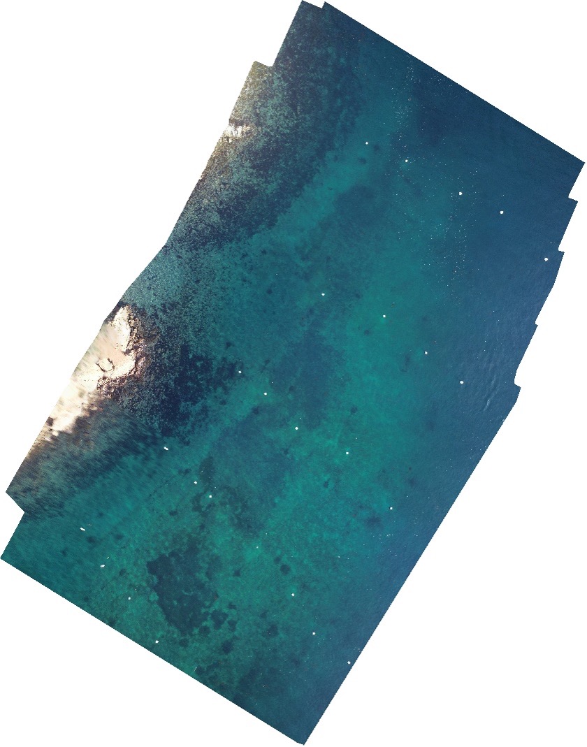
Image of Isthmus rhodolith bed January 2020. Taken from 70m
high. Orange arrows point to the Isthmus bed.
A great place to test drone ability to survey subtidal habitats is Santa Catalina Island. I became interested in rhodoliths, which are a free-forming calcifying red coralline algae, after being introduced to Dr. Diana Steller at MLML and her colleague Dr. Matt Edward at SDSU. I learned from them and literature that rhodolith beds are beaming with life from worms, juvenile urchins and snails, and so much more.
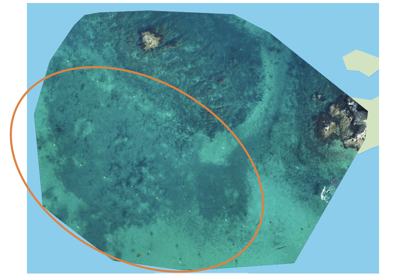
Image of the rhodolith bed at Emerald Bay January 2020. Taken at 70m high. Orange
circle is around the bed at Emerald Bay.
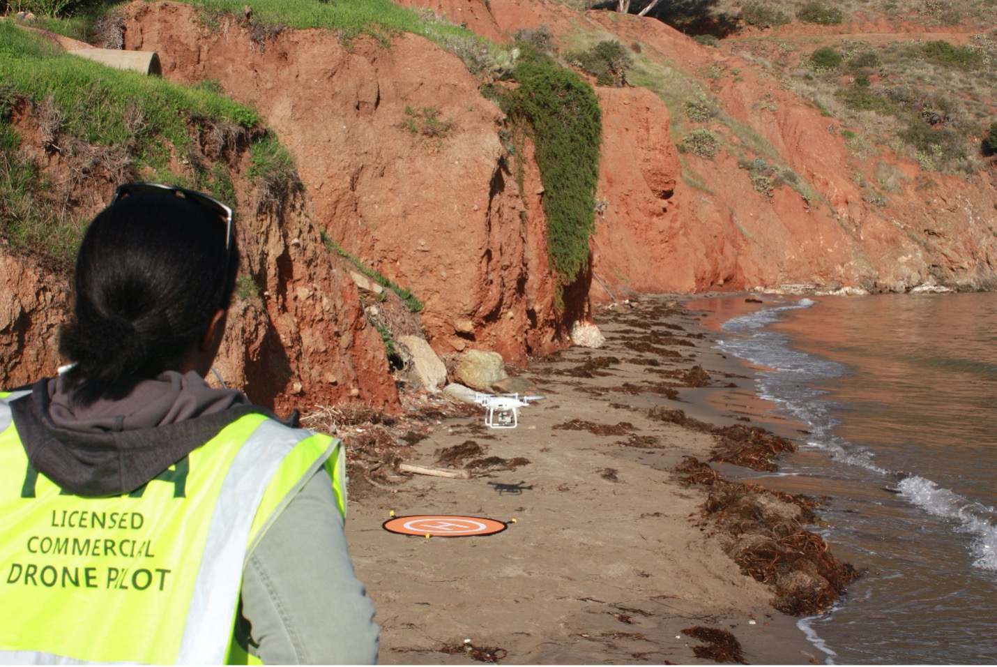
Catalina contains 7 beds within 6 different coves, and I will be comparing dive surveys and drone imagery for two beds of similar depth to detect and measure any differences in diving and drone measurements. I am measuring the perimeter (edge) and cover (total area and live rhodolith percent cover) of Emerald Bay and Isthmus Cove’s rhodolith beds. I was able to collect my first set of photos in January 2020 by flying a Phantom 4 drone using Pix4d software. I am using ArcGIS to process my images by measuring area and detecting perimeter, area, and scaring from mooring chains. I plan to collect my last set of photos at the end of the summer and run my final analysis. I hope your summer endeavors have gone well so far. Feel free to email me with any questions.
Best, Charnelle